
Climate Change Is Local
From Prince George’s County to Westernport, Marylanders are preparing for winter and spring while reckoning with what heavy rain can do close to home
By Maria Bellos Fisher
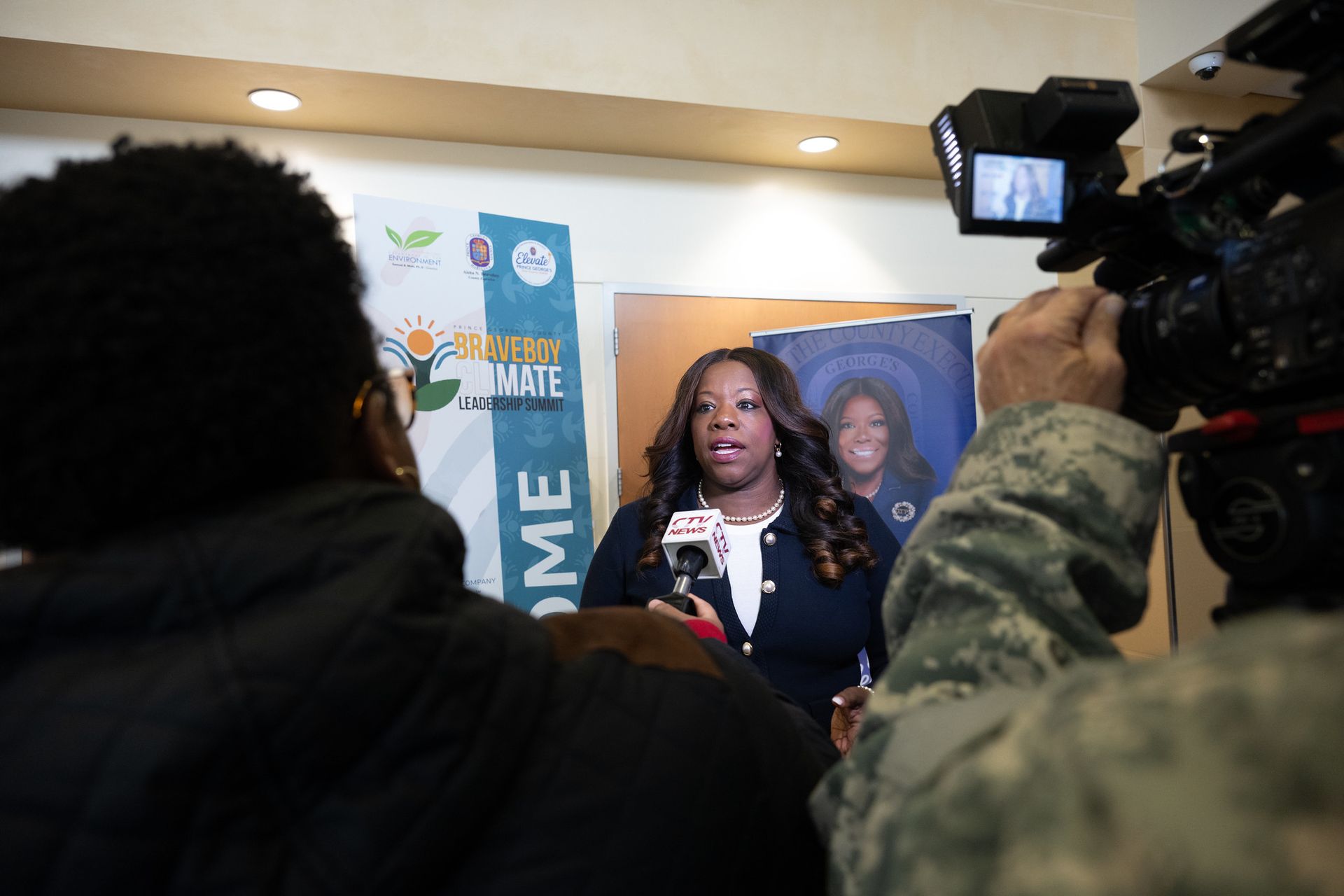
At Prince George’s County’s first climate leadership summit, County Executive Aisha N. Braveboy put the cost of a flooded basement in household terms. Climate change, she said, “could mean the difference between paying five thousand dollars in mold remediation from a flooded basement or investing five thousand dollars in your family’s future.”
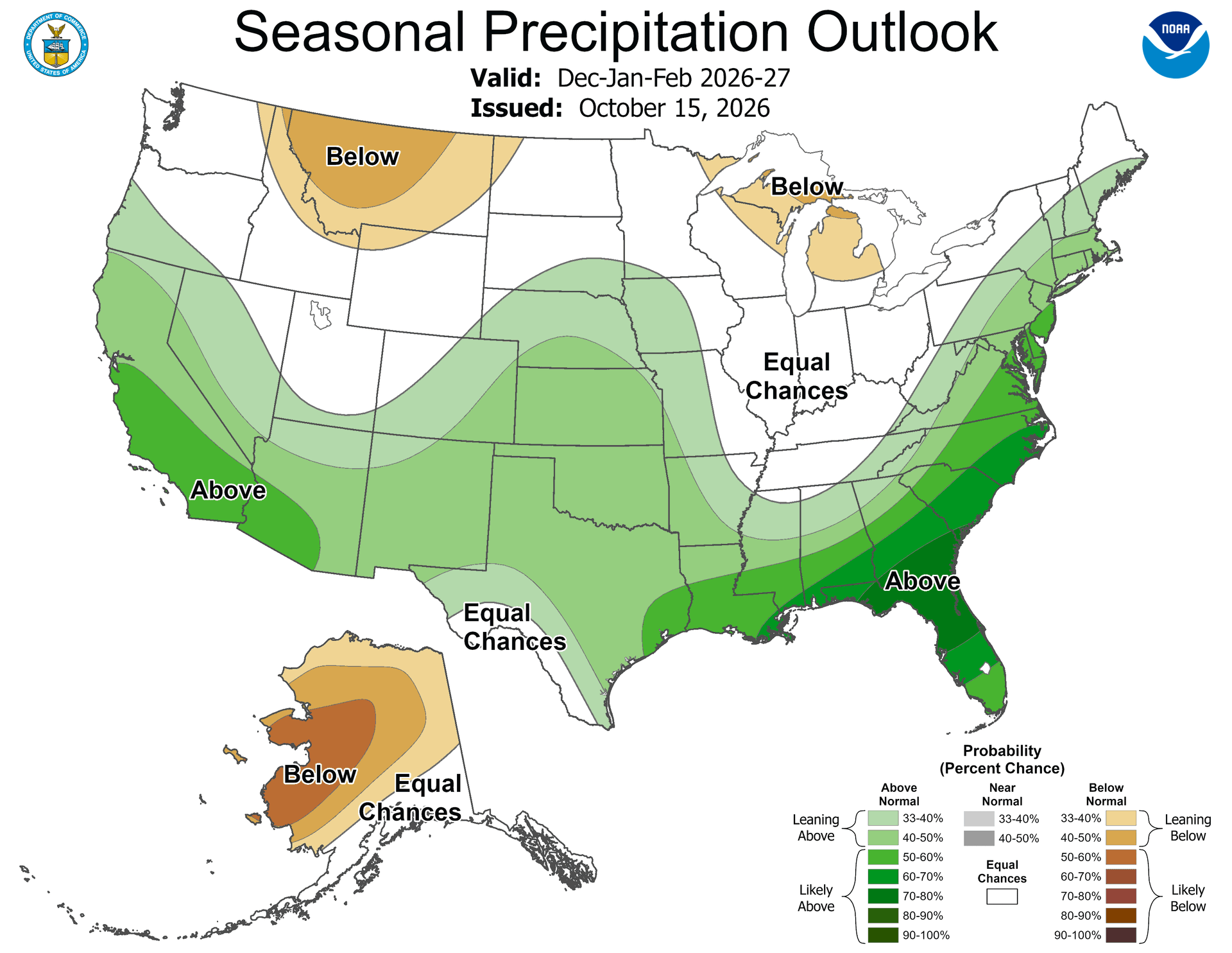
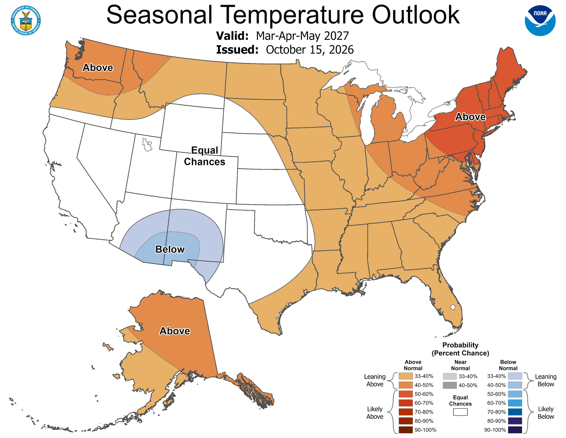
That was at Bowie State University in November 2025. A year later, county leaders are scheduled to return to Bowie State on Nov. 19 for another summit, with a fresh federal outlook in hand. The National Oceanic and Atmospheric Administration favors a warmer-than-normal winter and spring across Maryland. Its maps also tilt wet in central and eastern parts of the state, with less of a signal inland. For residents who have already watched water come up through a basement or across a road, the outlook offers a reason to ask what has changed since the last storm and what still needs fixing.
Maryland Environment Secretary Serena McIlwain brought that question down to street level at the first summit. “It shows up in Prince George’s County when a basement is flooded, not once, but over and over again,” she said. She pointed to seniors struggling to keep their homes comfortable, stormwater systems facing rain they were never designed to handle and the cost of insurance. Councilmember Wala Blegay spoke about high heating bills during cold weather and the danger of going without air conditioning in extreme heat. Their examples start in different seasons, but they lead to many of the same homes.
What NOAA sees through May
The Climate Prediction Center’s Oct. 15 outlook, the latest seasonal release as of Nov. 15, favors above-normal average temperatures for Maryland in November through January, December through February and March through May. Its precipitation maps show a wetter tilt around the Chesapeake Bay and toward the Atlantic. Parts of far western Maryland sit in or near the area marked “equal chances,” where NOAA gives roughly similar odds to wetter, near-normal and drier seasonal totals. The geographic difference matters in a state that runs from the Appalachian valleys to the Eastern Shore.
The outlook compares three-month averages or totals with the 1991–2020 climate record. A warmer seasonal average can include a stretch of bitter cold. In a season that tilts wetter, the extra precipitation could come in a handful of storms. And one intense downpour can inundate a street even in a season that finishes near normal. The maps provide a broad planning signal. As storms approach, local National Weather Service forecasts and warnings tell residents more about when rain could change to ice or when a creek could rise.
A major influence on this outlook is El Niño, the warming of the central and eastern equatorial Pacific that can shift storm tracks far from the ocean itself. In its Nov. 12 update, NOAA put the chance of a strong to very strong El Niño through January–March 2027 at more than 79 percent. That percentage describes the conditions in the Pacific. The separate outlook maps show how NOAA’s forecasters expect those conditions, along with other influences, to shape regional temperature and precipitation.
Maryland’s longer climate record tells another part of the story. The 2025 State Climate Summary reports that Maryland’s average annual temperature has risen by more than 2.5 degrees Fahrenheit since the beginning of the 20th century. Across Maryland and the District of Columbia, every five-year period from 2005 through 2024 averaged more two-inch precipitation days than the longer record. Those observations help explain why infrastructure designed around past conditions deserves a fresh look. For a household, the question can be as specific as where runoff goes after it reaches the end of the driveway.
How to Survive a Flood (National Weather Service)
Stay Informed: Listen to radio and television, including NOAA Weather Radio, if possible, check the Internet and social media for information and updates.
Get to Higher Ground: If you live in a flood prone area or are camping in a low-lying area, get to higher ground immediately.
Obey Evacuation Orders: If told to evacuate, do so immediately. Lock your home when you leave. If you have time, disconnect utilities and appliances.
Practice Electrical Safety: Don't go into a basement, or any room, if water covers the electrical outlets or if cords are submerged. If you see sparks or hear buzzing, crackling, snapping or popping noises--get out! Stay out of water that may have electricity in it!
Avoid Flood Waters: Don't walk through flood waters. It only takes 6 inches of moving water to knock you off your feet. If you are trapped by moving water, move to the highest possible point and call 911 if possible. Do NOT drive into flooded roadways or around a barricade; Turn Around, Don't Drown! Water may be deeper than it appears and can hide hazards such as sharp objects, washed out road surfaces, electrical wires, chemicals, etc. A vehicle caught in swiftly moving water can be swept away in seconds 12 inches of water can float a car or small SUV, 18 inches of water can carry away large vehicles.
WSSC water created a climate change vulnerability assessment. “We did an assessment that detailed modeling of a 2065 adjusted 100-Year storm flood levels across our service area, identifying the need of our most critical facilities and targeting that infrastructure, and then secondly establishing the greenhouse gas emissions plan, said WSSC Director Allison Dunn Wilson. The assessment found that the biggest bang for buck adjustment was through purchase or generation of renewable energy. About 73 percent of its greenhouse gas emissions come from the production of energy for off the grid to power to plants, pump water, and buildings.
Dunn Wilson added, “So, a plan is good, but action is even better. I'd like to highlight renewable energy actions that we implemented today for them. WSSC Water currently purchases wind, solar and is actively in the process of purchasing a lot of hydropower. One third of WSSC’s power consumption annually comes from wind power.”
A school evacuation and a long recovery
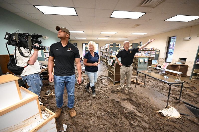
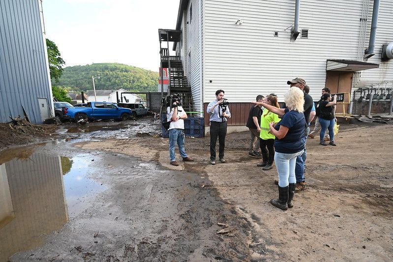
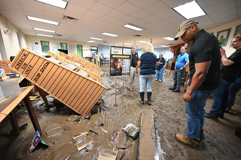
In Westernport, in Allegany County, the immediate question on May 13, 2025, was how to get children and staff out of an elementary school surrounded by floodwater. Heavy rain sent Georges Creek out of its banks, and responders evacuated people at Westernport Elementary by boat. When Gov. Wes Moore toured the town two days later, the stops along Main Street included the fire hall, the library, local businesses and the school. The school reopened for the next academic year. Some families faced repairs well beyond that milestone.
Basements mattered there, too. The Western Maryland Long Term Recovery Committee reported that many homes took water in basements and first floors. In houses where furnaces and water heaters were downstairs, a spring flood left families facing the next winter without equipment they relied on. The committee was still coordinating assistance in September 2026, connecting residents with volunteers, construction help and partner organizations. A regional development agency involved in the effort expects the broader recovery work to take several years.
Westernport illustrates how a climate-related risk carries across seasons. The hills and narrow creek valley help determine where runoff collects, and the locations of buildings and roads help determine who gets cut off. Maryland’s record of heavy precipitation provides context for that exposure. The May 2025 flood itself shows how quickly the local consequences can unfold. Even with a weaker seasonal precipitation signal in western Maryland, the town goes into spring 2027 with recovery work underway and a recent example of how fast high water can disrupt a school day.
Who is helping before and after the rain
In the Anacostia watershed, the nonprofit Alliance for the Chesapeake Bay helps residents in parts of Prince George’s and Montgomery counties maintain stormwater projects. Its resource center offers a property owner’s guide, and its watershed pilot lists site inspections and written maintenance recommendations for eligible property owners. This is practical work. Installing a rain garden is one step. Keeping its inlet clear and checking where water flows after a storm are part of keeping it useful. The Alliance’s resource center is a starting point for residents who already have stormwater features and want to know how to care for them.
Prince George’s County also offers a way for eligible property owners to offset some costs of putting those features in place. Through its Rain Check Rebate Program, the county and the Chesapeake Bay Trust cover qualifying projects such as rain gardens, rain barrels and permeable pavement. Owners can check approval requirements before starting. Bowie administers its stormwater program separately. A yard project can help manage runoff from a roof or paved surface, while the capacity of a neighborhood’s drainage network remains a public infrastructure question.
In Western Maryland, the Long Term Recovery Committee works on the other side of the storm. Formed in September 2025, the community-based coalition brings together faith groups, civic organizations and public partners to address needs that remain after the emergency response. That can mean connecting a household with a volunteer crew or helping line up resources for repairs. Families affected by the flood can reach the committee through its website. Its work shows what recovery looks like after streets reopen, when individual households are still trying to make their homes livable.

Getting a home and a county ready
For Prince George’s residents worried about heating costs, Maryland’s Office of Home Energy Programs accepts applications for utility bill assistance online and through local offices. The state’s weatherization program addresses the home itself through energy-efficiency improvements for eligible households. Renters can use the winter months to ask building managers how to report water coming in or heat going out, especially outside business hours. Prince George’s County’s emergency management office also provides preparedness information and training for residents and community organizations.
At the scale of a utility, preparation involves decisions that can last decades. In her remarks at the 2025 summit, WSSC Water’s Allison Dunn Wilson described how the utility modeled future flood conditions and looked at which facilities would need protection. WSSC’s published vulnerability assessment evaluated how heavier precipitation, sea-level rise, storm surge and temperature extremes could affect its system. Its modeling looked ahead to 2040, 2065 and 2100. For customers who depend on the utility every day, those dates translate into decisions about which facilities to protect as equipment and buildings are repaired or replaced.
The original summit also asked what Marylanders can do about the warming behind those long-term changes. The energy it takes to heat and cool a home, the fuels used by a vehicle fleet and the trees a community keeps or plants all involve choices about emissions or exposure to heat. A resident may be able to seal a draft or help care for a street tree. A county agency can decide which buildings get upgrades, where drainage needs more capacity and which neighborhoods receive those investments first.
“It’s what you build and where you build it,” McIlwain told the 2025 summit. “It’s how you invest your public dollars.” When county leaders meet again at Bowie State, those choices have a near-term scale as well as a long one. By spring, residents can look for specific answers about the drains that back up, the buildings that lose heat and who will help if the water comes in again.

This is paragraph text. Click it or hit the Manage Text button to change the font, color, size, format, and more. To set up site-wide paragraph and title styles, go to Site Theme.
